Land Surveying
- Home
- Land Surveying
Surveying plays the major role in every Geometrics related projects. Surveying being the sole of the project, it is extremely important right from the planning to the development stage of the project.
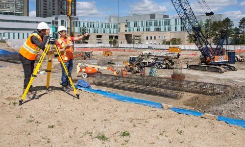
We understand the Importance of the surveying part very well. Our team has done an ample number of projects and rendered successful results to our clients. We specialize in basic to advanced surveying techniques. Land surveying is the process of determining the precise location and measurement of land, including its boundaries, contours, and other physical features. This is typically done to create maps, define property boundaries, and to aid in construction and development projects. Surveyors use a variety of tools and techniques to gather data about the land, including GPS, laser scanning, and traditional instruments like theodolites and total stations.
This data is then used to create accurate maps and plans, which can be used by engineers, architects, and other professionals to design and build structures on the land. Land surveying has a long history, dating back to ancient civilizations such as Egypt and Greece, where it was used to divide land for agricultural purposes. today, land surveying plays a critical role in a wide range of industries, from real estate and construction to mining and forestry.
Various Aspects of Land Surveying
Property Boundary Surveying: It involves measuring and marking the corners and lines of a piece of land to ensure that it is correctly defined and that there are no boundary disputes or conflicts with neighboring properties.
Topographic Surveying: Topographic surveying involves collecting data about the contours and physical features of the land, such as hills, valleys, and waterways
Construction Surveying: Construction surveying involves providing accurate measurements and data to
aid in the construction of buildings, roads, and other structures
Geodetic Surveying: It involves the precise measurement of the Earth’s shape and gravity field. This type of surveying is used in applications such as satellite positioning, map-making, and earthquake monitoring.
Hydrographic Surveying: Hydrographic surveying involves the measurement and mapping of bodies of
water, including rivers, lakes, and oceans.