GIS Mapping
- Home
- GIS Mapping
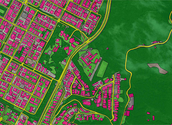
GIS deals with the information about the earth and its features. The spatial and non-spatial data of the Earth’s surface are managed precisely with the GIS technology. GIS mapping services refer to the use of specialized software and tools to create, analyze, manage, and present geospatial data. GIS mapping services allow users to visualize and understand geographic data and relationships between different types of data that are tied to specific locations. GIS mapping services typically involve the collection of data from various sources, such as satellites, aerial imagery, and ground surveys, and the integration of this data into a single database. The data can then be analyzed using GIS software to generate maps, charts, and other visualizations that can be used to inform decision-making processes in a variety of fields, including urban planning, natural resource management, emergency response, and public health. GIS mapping services have become increasingly important in recent years as more and more data is being collected about the world around us. With GIS mapping services, users can explore this data in new ways, uncovering patterns and relationships that might not be apparent otherwise. Additionally, GIS mapping services can help organizations improve their operations and decision-making processes by providing them with more accurate, up-to-date information about the areas they serve.
Key Components
Data Collection: GIS mapping services involve the collection of geospatial data from various sources, including satellite imagery, aerial photography, GPS, and ground surveys
Data Management: GIS mapping services require the efficient management of geospatial data. This involves organizing and maintaining data in a structured and logical way to ensure that it is accurate, up-to-date, and easily accessible.
GIS Software: This software is designed to handle large amounts of data and provides a range of tools for data analysis and visualization.
Mapping and Visualization: GIS mapping services involve the creation of maps and other visualizations that display geospatial data in a meaningful way. These maps can be used to identify patterns and relationships within the data, as well as to communicate complex information to a broad audience.
Analysis and Modeling: This can involve spatial analysis, statistical analysis, and predictive modeling to help identify trends, patterns, and relationships within the data.
Integration with other systems: GIS mapping services can be integrated with other systems to provide
more comprehensive data analysis and visualization