

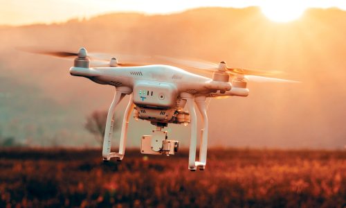
Unmanned Aerial Vehicles (UAVs), also known as drones, have become increasingly popular for surveying applications in various fields such as agriculture, construction, environmental monitoring, and land surveying. UAV surveys offer many advantages over traditional surveying methods, including faster data collection, increased accuracy, and reduced cost. UAVs are equipped with sensors such as cameras, LiDAR, and GPS, which can capture high-resolution images, 3D models, and precise location data. This allows for efficient and accurate mapping of areas that may be difficult or dangerous to access by traditional methods. UAV surveys can be used to gather information about a wide range of features and characteristics such as land topography, vegetation health, infrastructure condition, and water quality. The data collected by UAV surveys can be processed and analyzed using specialized software to generate detailed maps, models, and reports. Overall, UAV surveys are a powerful tool for collecting accurate and reliable data in a range of industries, enabling more informed decision-making, and driving improvements in efficiency and productivity. One of the key advantages of UAV surveying is its ability to collect data quickly and efficiently over large
areas. This can save time and reduce the cost of data collection, while providing more accurate and
reliable results compared to traditional surveying methods.
One of the key advantages of UAV surveys is their ability to collect data in areas that are difficult or impossible to access by traditional surveying methods. For example, drones can be used to collect data in steep or rugged terrain, or in areas that are inaccessible due to natural disasters or other hazards. The sensors used in UAV surveys can vary depending on the application, but typically include cameras, LiDAR, and GPS. Cameras can capture high-resolution images that can be used to create maps and models of an area. LiDAR sensors can be used to generate detailed 3D models of the terrain, while GPS can provide precise location data for each image or data point collected. The data collected by UAV surveys can be processed using specialized software to generate maps, models, and other types of surveying data. This data can be used to make informed decisions about a project or to provide valuable information for planning and management purposes. UAV or drone surveying is a process of collecting and analyzing data using unmanned aerial vehicles or drones. These vehicles are equipped with a range of sensors, including cameras, LiDAR, GPS, and other instruments that can capture high-resolution images, 3D models, and precise location data